I was born and raised in Anchorage, Alaska, but knew I always wanted to move to Texas. This past summer of 2019, I made it happen.
————————————————————————————
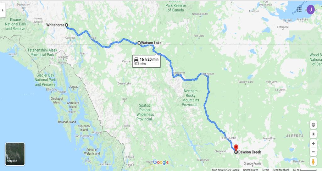
Day 3 started in Whitehorse, Yukon Territory. We planned little in the way of stops, knowing we would have a long day of driving ahead of us.
We passed by Marsh Lake after leaving Whitehorse, and within the hour, passed by Jake’s Corner, which intersects the Alaska Highway with Tagish Road (Highway 8) and takes you back westward to Carcross.
Johnson’s Crossing was picturesque with its deck truss bridge that runs over the Teslin River before it enters Teslin Lake.
Teslin was memorable for its bridge as well. The Nisutlin Bay Bridge crosses Teslin Lake, 31 miles (50 km) South of Johnson’s Crossing. The bridge is the longest on the Alaska Highway. It has seven Warren truss arches and a steel-grated deck, making for a noisy passage.

Teslin also houses a cardboard cutout cop car, preventing would-be speeders from zooming through town.
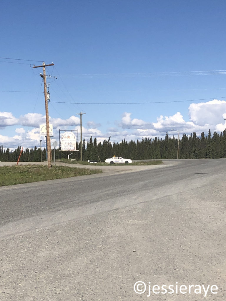
We stopped for some highway construction, but were moving again within an hour. We reached the border to British Columbia at Morley Lake around 30 minute after leaving Teslin. We were only in British Columbia for about 50 minutes before we crossed back up into the Yukon Territory again.
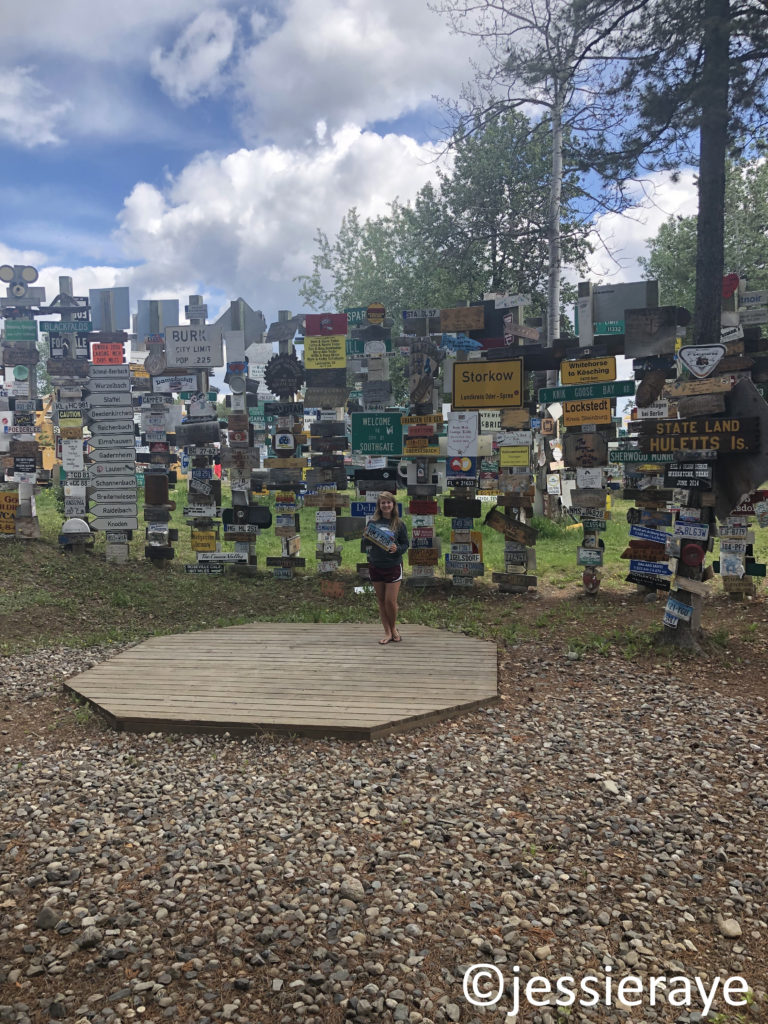
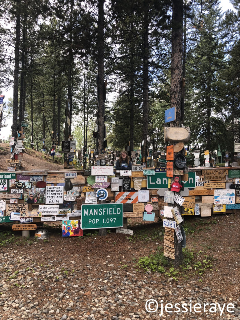
We made it to Watson Lake in a little under 2 hours. We were worried we would miss the Sign Post Forest that we had added to our bucketlist, but it was impossible to miss as we drove through town.

Sign Post Forest is known for its collection of license plates, directional posts, and signage brought from all over the world.

The tradition began in 1942 when a U.S. soldier by the name of Carl K. Lindley was directed to fix the directional signpost outside the Military Air Base. He completed the repairment, but also added a directional signpost for his own hometown of Danville, Illinois. This inspired other soldiers to add their own hometown signposts, eventually growing to become a forest of over 80,000 signs.1 Travelers are welcome to add their own signs to the ever-growing collection.
The border back into British Columbia was only about 10 minutes away.

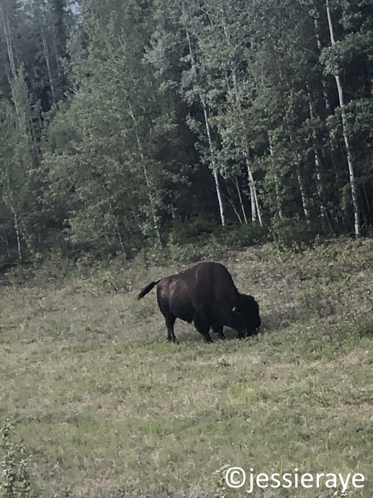
Right after crossing the border, we spotted two large creatures on the left side of the road, causing us to slow down to take a closer look. There were 2 bison lying down in the grass that lined the highway.

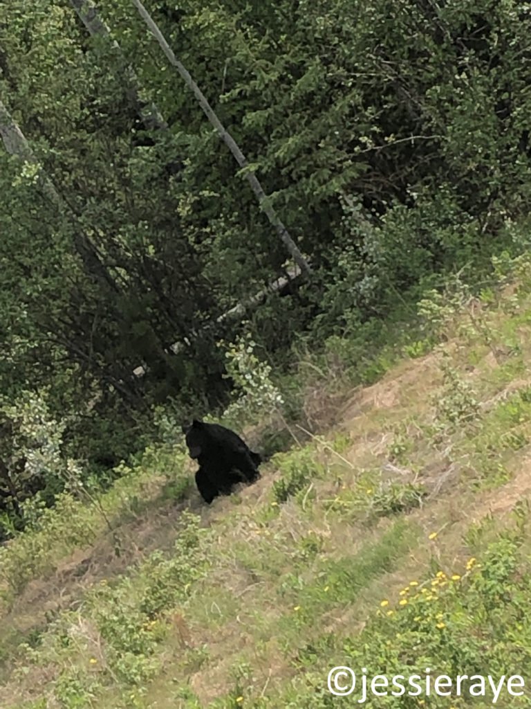
More movement to our right caught our eye. On the right side of the car, a black bear was sitting in the grass as well.
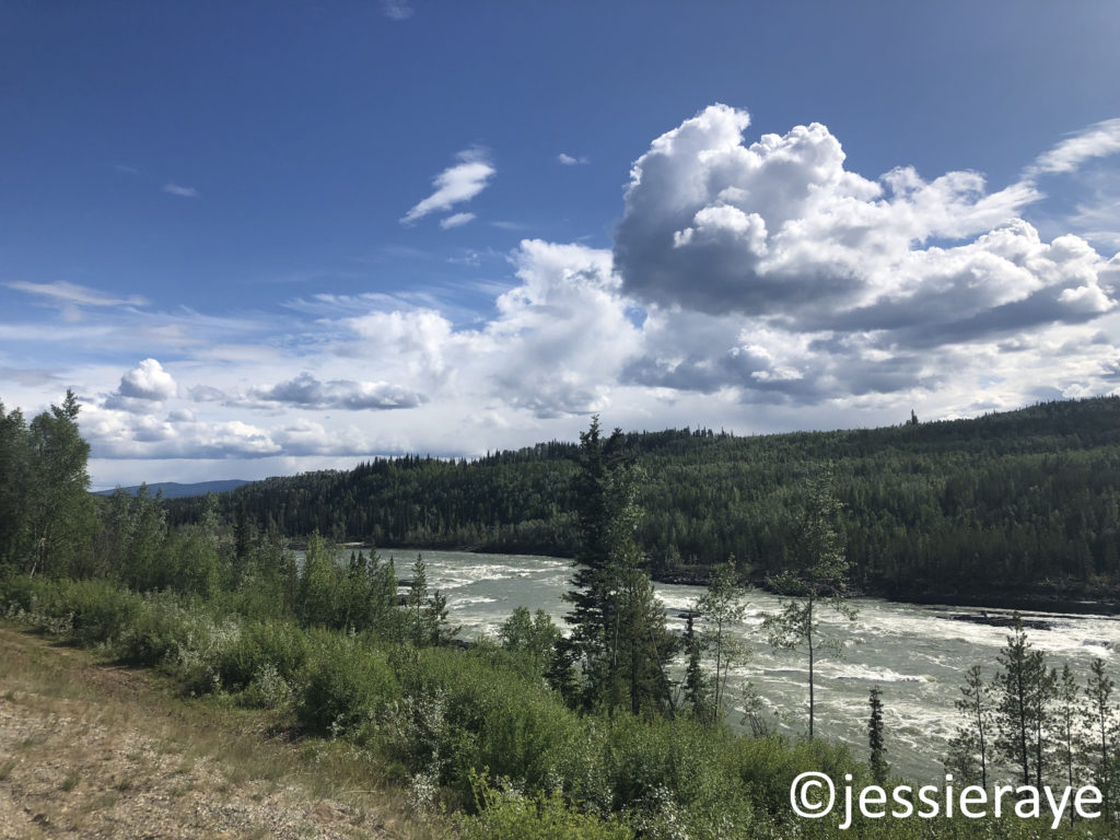
Leaving the bison and black bear behind, we drove alongside the Liard River for 131 miles (210 km), crossing twice more across the Yukon Territory border and then back into British Columbia for the final time.
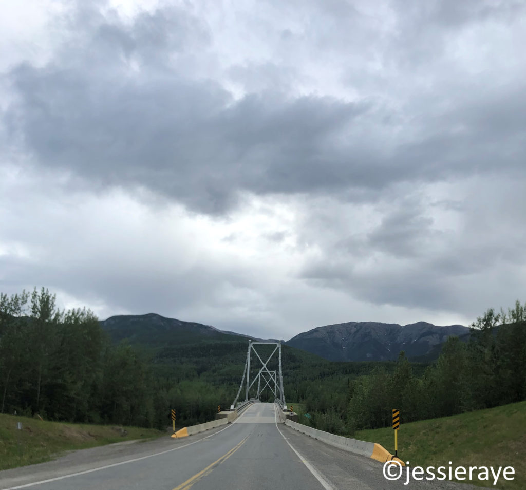
We spotted another black bear alongside the road that afternoon, but the real excitement began up the road 20 minutes later, right after crossing the Liard River Suspension Bridge.

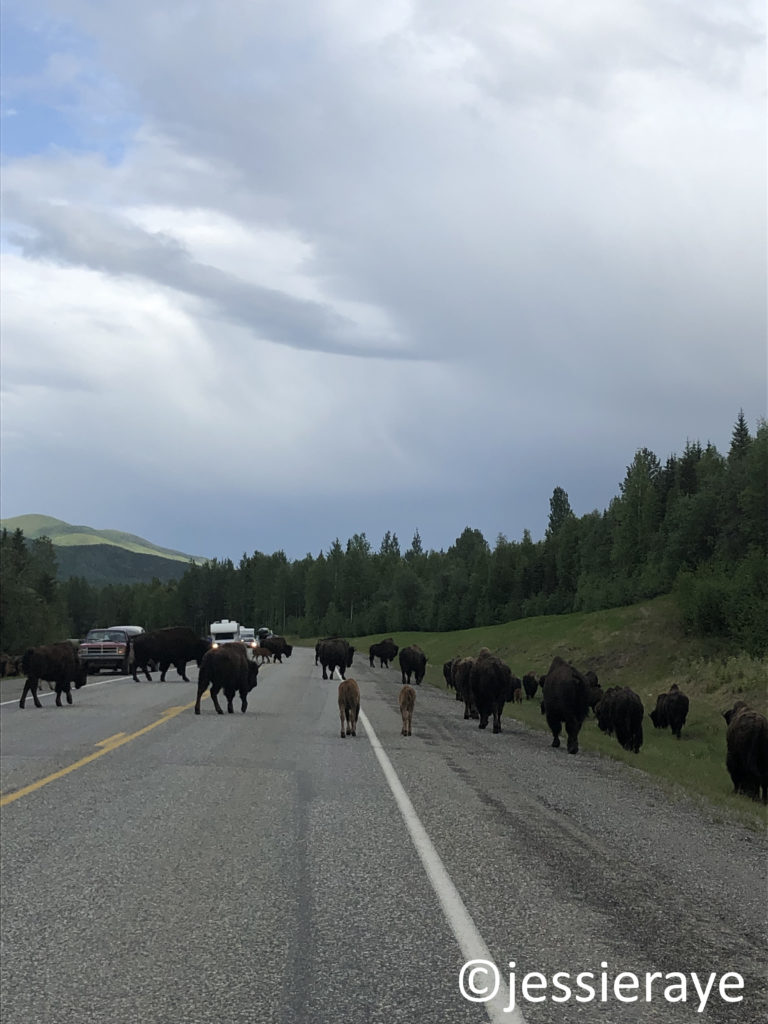
We came upon a large herd wood bison, complete with bison calves. They walked around our car, as well as other vehicles that were also stopped by their crossing. It took another 20 minutes for the herd to clear.


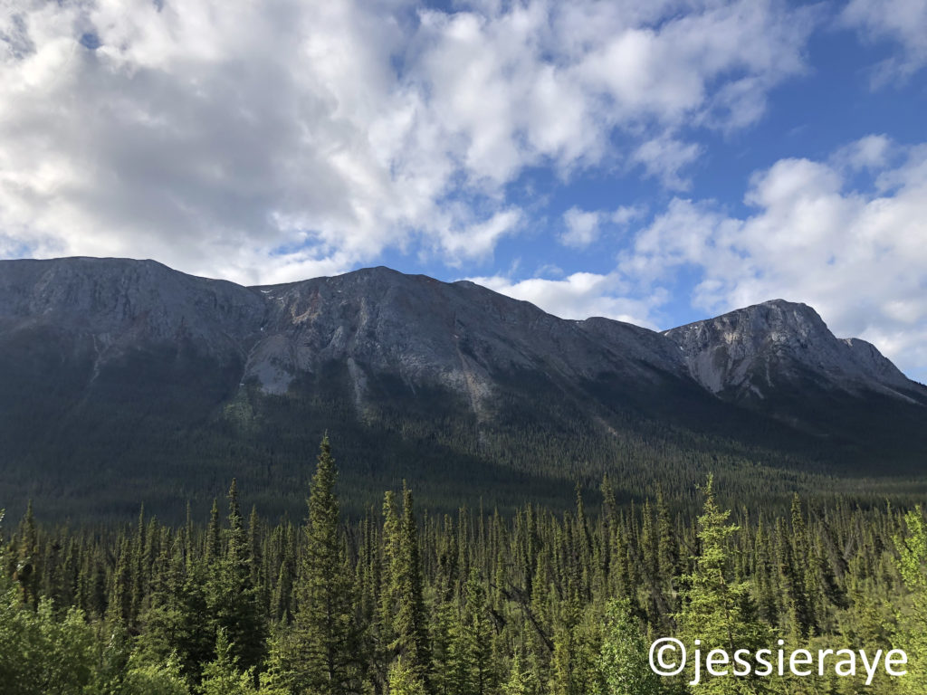
Once the bison cleared the road, we continud on through the Northern Rockies and into Boulder Canyon where there was an easy pull-off for the U-Haul.
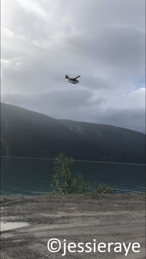
There was a mother and baby porcupine right before we reached Muncho Lake. Minutes later, we watched a float plane land on the smooth waters that butted right up against the winding highway.
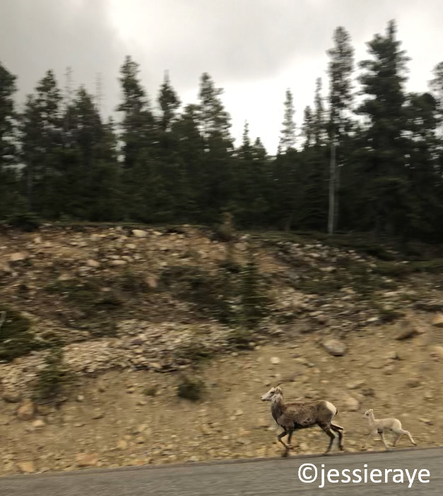
The highway continued into Stone Mountain Provincial Park, which overlooks McDonald Creek and the sheer cliffs that border the highway. Steep cliffs rose to our left as well. We were moving slowly around the sharp turns of the road and were able to stop quickly when a large band of Bighorn Sheep came into view in front of us. They were hesitant to move off the road, but an oncoming semi-truck convinced them otherwise.

We turned into a pull-off and watched as the adult sheep jumped over the highway railing, while the baby sheep slid underneath it, taking off down the steep incline towards the river below.
Our next big stop was Fort Nelson, British Columbia, moving us into Mountain Standard Time, and losing us another hour. We filled up with gas and continued towards Dawson Creek, which was still 282 miles (453 km) away.
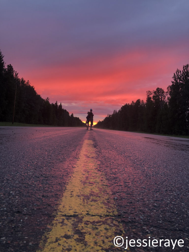
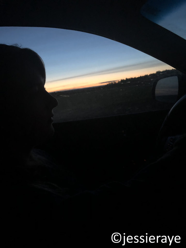
We watched the sun melt behind us into brilliant shades of red, pink, and orange during the 10:30 PM sunset.
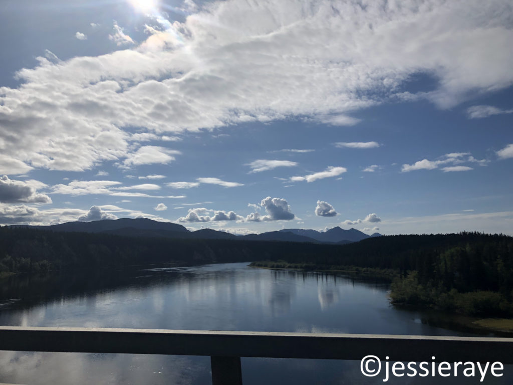
Three and a half hours later, the gas light came on with at least 30 miles (53 km) to the closest town of Fort St. John. There were no open gas stations along the highway since our last fill up. Luckily, we had planned for such an event, and used our spare gas can to top the tank off.

I drove us the final stretch into Dawson Creek as we watched the sun come up over the Peace River.
We had once again booked a hotel using Priceline, this time at Days Inn by Wyndham Dawson Creek. We crawled into our beds around 4 AM and were asleep before our heads even hit the pillow.

Our total time for Day 3 was 19 hours and we traveled 872 miles (1404 km), 625 (1005.8 km) of those miles being British Columbia.
#jessieraye #anchorage # anchoragealaska #alaska #alaskahighway #alcanhighway #roadtrip #roadtrips #alaskatrip #adventure #travel #shelties #shetlandsheepdogs #thelastfrontier #49thstate #june2019 #june #eagleriver #palmer #wasilla #sutton #chickaloon #glacierview #eureka #nelchina #glenallen #tok #valdez #deltajunction #rainbows #sunsets #alaskasunsets #glenhighway #richardsonhighway #matanuskaglacier #glaciers #moose #alaskasummers #summer #alaskatotexas #pottersmarsh #moving #nissan #nissanmurano #canada #canadianborder #canadiancustoms #yukonterritory #beavercreek #burwashlanding #kluanemuseumofnaturalhistory #forestfires #alaskaforestfires #canadianforestfires #destructionbay #kluanelake #kluanenationalpark #whitehorse #dawsoncity #dawsoncreek #watsonlake #priceline.com #priceline #pricelinehotels #canadasbestvalueinn #historicalaskahighway #gatewaytothe49thstate #largerthanlifeplusgrandquenature #highways #hainesjunction #haineshighway #kathleenlake #haines #hainesalaska #dallsheep #britishcolumbia #yukon #goldrush #uhaul #roadtripmiles #roadtripkilometers #realcanadiansuperstore #marshlake #jakescorner #tagishroad #carcross #johnsonscrossing #teslinriver #teslinlake #bridges #canadianbridges #teslin #nisutlinbaybridge #warrentruss #highwayconstruction #canadacops #morleylake #signpostforest #licenseplates #carlklindley #danvilleillinois #britishcolumbiaborder #bison #woodbison #bisonvsbuffalo #bisonversusbuffalo #bear #blackbear #liardriver #liardriversuspensionbridge #bisoncalves #bisonbabies #northernrockies #bouldercanyon #porcupine #porcupines #muncholake #floatplanes #flying #lakelandings #pilots #stonemountain #stonemountainprovincialpark #mcdonaldcreek #bighornsheep #bighornsheepbabies #semis #semitrucks #fortnelson #mountainstandardtime #pacificstandardtime #alaskastandardtime #sunsets #canadasunsets #canadiansunsets #canadian sunrises #canadasunrises #sunrises #highwaysunsets #redsunsets #lowfuel #runningonfumes #empty #emptytank #gaslight #fortstjohn #peaceriver #daysinnbywyndham #daysinn #day1 #dayone #day2 #daytwo #day3 #daythree